

A longtime town resident and ham radio enthusiast, Charlie Bures, WA3ITR, reports he has been involved with a Natick High School High Altitude Balloon (HAB) launch. The STEM project carrying an Amateur Radio tracking device and GoPro cameras was launched on Wednesday, June 20. The project was funded by the AeroClub of New England, the oldest AeroClub in the Americas, via the David Frawley Foundation.
“I’m working with the science teacher, Mr. Donald (Clark) Clements, at the Natick High School,” said Bures prior to the launch. “We have a light-weight triangular platform with three GoPro cameras and two GPS trackers attached by a 20-foot flight line to a 600g latex balloon (weather balloon). We inflate it with about 45 cubic feet of pure helium. We are also monitoring the jet streams so that our balloon platform doesn’t go into the Atlantic, but hopefully lands around the Natick area, or at least outside Route 128 away from congestion and major highways.”
The dozen students or so worked twice weekly this spring after school to learn about space, the weather profile, aviation, flight planning, and measuring the endurance of their battery/camera systems. Using flight-planning software, they ran simulations under various parameters using real-time jet-stream data to see where their balloon package would land. By adjusting the starting location, they were hoping to have the package land in the Natick vicinity.
On Wednesday, June 20, the Natick High-Altitude-Balloon Group launched their platform at 4:07 p.m. from the Hatfield, MA Elementary School, near Northampton in the middle of Massachusetts. The automatic packet reporting system (APRS) tracking device used Charlie’s call-sign of WA3ITR with a dash-7. APRS is a popular amateur radio system used for tracking moving vehicles, or humans on bikes or hikes.
From the APRS track shown below, the HAB was up to 45,000 feet over Worcester, traveling east at over 85 MPH. It circled over South Natick and Framingham, reaching up to 91,953 feet before it burst. It continued toward the Atlantic as it parachuted back to the ground. Although the plan from the simulations was for the HAB to land in the Natick area, that wasn’t going to happen as it sped to the east.
The chase team, unfortunately, couldn’t go that fast.
The last APRS point was in East Weymouth at about 500 feet above the ground (AGL) at 6:38 p.m. The Natick group hoped to find it, since the three GoPro cameras were only recording photos to their internal micro-disks.
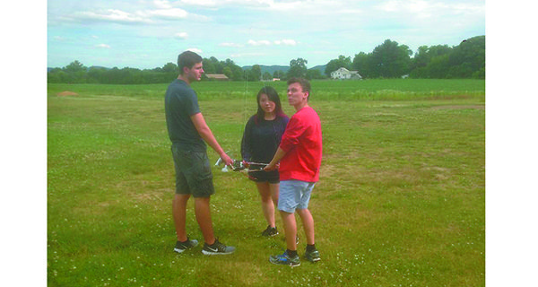
Luckily, the team spotted it around 7:10 p.m. in a farmer’s field in Hingham. He gave them permission to recover it.
Now, the group will be checking the three cameras to see if there are any photos - and, if there are, making a short video or photo album.