


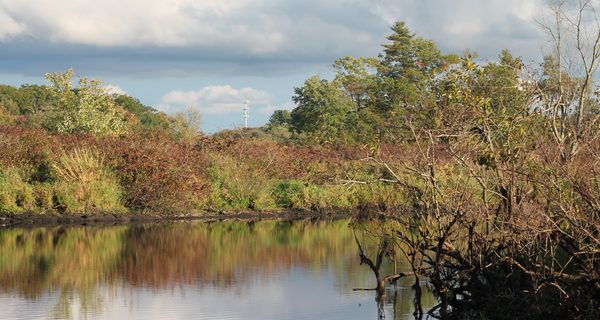
While the northern half has more interesting things to see, the southern portion of the loop has better views of the Charles.
By James Kinneen
Hometown Weekly Reporter
Technically, the Charles River Reservation Loop is one trail. But with Route 27 slicing it in two, and with no alternative to waiting for the road to clear and crossing the street, it’s really two unique trails that share only a name. One of the trails is much more interesting than the other, although which one that is might depend on why you’re hiking.
When I went there on Friday, I parked just off the highway and did the southern loop first. The southern loop is probably best for those of you that love nature and seclusion. Essentially, you pull off of Route 27 into a parking lot, cut into the woods and follow the Charles River, occasionally slicing through the trees to get an unobstructed view. Eventually you get to a field and cross it, where you continue along a paved road until you once again hit the banks of the Charles.
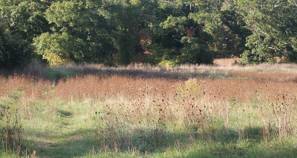
The online reviews of this hike are terrible, and I don’t really understand why. The AllTrails webpage has people complaining about “unclear directions,” which is odd, because there aren’t many diverging trail options: there’s a giant river and you follow along. That’s pretty much it. Another review complains that “parts of the trail meander through open field with no clear markings.” This is also true, but it should be pretty clear where to walk when the grass is patted down in a straight line.
Nonetheless, the one bad thing about the hike is that you have to cross a busy street with no light or crosswalk to help you, and walk along Route 27 for about fifty yards. This is a shame, because it limits how family-friendly the hike is, and because it thusly lessens the number of people that can see the more interesting northern side. If possible, a crosswalk would be nice.

After crossing, I was immediately greeted by a sign noting this was the Medfield State Hospital Cemetery, in which someone had stuck a pink flower. I was glad to see it being treated with such respect and reverence, because with Halloween approaching, our obsession with “haunted” and “spooky” places is about to kick into overdrive.
After a long walk through some tall grass, you hit the Bill Martin Air Field. While there were some kids there, they said they weren’t going to fly anything, which was disappointing. I’m also a bit ashamed that until I came home and Googled it, I thought this was a legitimate airfield and couldn’t believe how little runway there was. While all my knowledge of runway length necessity originates from the 65 percent of the Tom Cruise movie, “American Made,” that Amazon Prime tells me I once watched, I still should have realized that even the smallest plane couldn’t land with this little space.
Walk bit further and you hit a bridge where you can cross along the train tracks. As someone who grew up watching one hundred percent of “Stand By Me,” I opted not to attempt to cross this bridge. However, a teenage girl who has assuredly never seen the River Phoenix/Wil Wheaton classic didn’t hesitate to cross it.

Overall, I think the Charles River Reservation Loop is hugely underrated. In one hike, you can get a bit of history, some thrill-seeking, plenty of nature, and if you're lucky, gain some remote-control airplane knowledge. That's not bad for just over four miles.


